
Walk Summary
After yesterdays rest day, partly enforced by the poor weather but also to give the old bones a rest I was quite keen to get out on the hill today. Unfortunately overnight rain was slow to clear leaving a damp feel in the glens close to drizzle. If it is like this at glen level I am sure it will be a lot worse higher up.
After nearly 10 days of walking most of my short day options on the trip plan had been used up, but there was one I had up my sleeve which I was really saving for a future trip to pick off during a stop-over in Tyndrum when driving further north to say Isle of Skye, Northern Highlands or simply just north of The Great Glen.
The peak in question was Ben Challum [Beinn Challuim] and the route in question was an 8 mile circular route from Auchtertye Farm up Allt Gleann a' Chlacaln, up the NW ridge of Ben Challum, continuing on to the South Top and returning via the sub-Graham Top of Creag Loisgte and finally along the WHW back to Auchtertye Farm.
Unfortunately John had returned home a couple of days early leaving me to carry on bagging alone. I had read in Ralph Storers Ultimate Guide to the Munros Vol 1 that the NW ridge was a bit craggy and that combined with the damp conditions I opted for the shorter up and down option from the A82 via Kirkton Farm.
Walk Statistics
Walk Date - 10 October 2014
Walkers - Steve Smith
Accommodation - By The Way Campsite and Hostel, Tyndrum
Start Point - Layby on A82 north bound just before WHW crossing (GR - NN 35922 27744)
Start Time - 10:20
Finish Point - Layby on A82 north bound just before WHW crossing (GR - NN 35922 27744)
Finish Time - 15:08
Duration - 4hrs 48mins
Average pace - 1.59mph
Distance Walked - 7.61miles
Height Ascended - 991.95metres
Other walks on this trip
2014
September
30th Conic Hill & Gualann
October
01st Ptarmigan & Ben Lomond
03rd Meall Corranaich & Meall a' Choire Leith
04th Ben More & Stob Binnein
05th Not quite Meall Buide (Glen Lyon)
07th Cruach Ardrain & Beinn Tulaichean
08th Beinn Dorain & Beinn an Dothaidh hammerhead
10th Ben Challum [Beinn Challuim]
12th Beinn a' Chreachain & Beinn Achaladair
13th The Tyndrum Grandslam
Peaks visited
Munro (282)
Ben Challum [Beinn Challuim] (29)
Murdo (443)
Ben Challum South Top [Beinn Challuim South Top] (38)
Ben Challum [Beinn Challuim] (39)
Corbett (221)
NONE
Graham (224)
NONE
Marilyn (1218S - 1552E,W&S))
Ben Challum [Beinn Challuim] (29S - 100E,W&S)
Hump (2168S - 2976E,W&S)
Ben Challum [Beinn Challuim] (39S - 158E,W&S)
S: Scotland.
E,W&S:England,Wales & Scotland
Route
Walk Description
Ben Challum South Top [Beinn Challuim South Top]
Only a short walk from By The Way Tyndrum, but by the time I had parked the van at walks start point in the layby near the WHW crossing point on the A82 and crossed the bridge over the River Fillan, the drizzle had stopped and the mist was clearing to reveal peaks both north and south. I could also make out the ridge beyond Kirkton Farm which I think is Creag Loisgte, but could see no sign of the days target Munro Ben Challum. The mist seemed to be hanging about around the top of the ridge masking anything that may be revealed beyond. In any event I was not expecting any more because even on a clear day I understand the higher peaks beyond cannot be seen until the ridge is gained. So dressed for 20 minutes in to the walk without my coat I shook off the early chill and pressed on past Kirkton Farm, remains of St. Fillan's Church and both cemeteries following the private road to the farm then unmade track to the rail line.
There is a footbridge off to the right, over the rail line that I intended to use but in the absence of a clear path I missed it and crossed the rail line at the track crossing. The first and only deviation from the intended route.
On the other side of the rail line stay on the track briefly looking for a path off to the left around a hillock and stay left to join a more obvious muddy path this side of the fence line. From the map I was expecting a thick mixed forest but in reality it is fairly recently and sparsely planted. But regardless of this the fence is there to follow on the north west side all the way to the first summit, the sub Graham Top of Creag Loisgte. Not a well known peak I am sure, in fact the path continues to the left of the summit, but as a "sub" top of any type is definitely of interest to me.
On a clear day it would give a good view of the route ahead but today with the return of the drizzle and low cloud I could only just about make out the scar of the muddy track heading north east towards Beinn Challuim South Top.
Returning to the path and descending to the bealach, as well as the path there was the fence on the left to handrail until it disappears half way up Beinn Challuim South Top. Beyond the fence the path remains easy to follow. The only thing to watch out for in poor visibility is to not confuse the first cairn with the summit. The main summit, although not visible today, is another 100m further on. I only mention it to avoid a repeat of an earlier mistake this trip, but I think it is unlikely that anyone would be heading for the south top without the intention to carry on to the Munro. Anyway, for the avoidance of doubt the summit area is a cairn and a rocky prominence, not a lonely cairn on the ridge.
Ben Challum [Beinn Challuim]
Continueing straight over the south top and down in to a gully resulted in me having to reascend the other side to what appeared to be half way along a fairly exposed ridge. In fact it just about gives the sensation of a short ridge walk, but if you want to enjoy its full benefits return to the path to the west of the summit and follow it towards the start of the ridge. The narrowness only lasts for a short while before broadening out where the path continues down the bealach before reascending to the summit and cairn of the days main event - Ben Challum [Beinn Challuim].
Not much to report I am afraid because the cloud was blocking any views, so after a few photos of the summit I returned the way I came but this time stayed on the narrow part of the ridge before passing to the right of the south top summit.
Visibility was not brilliant but the path was easy enough to follow on the required bearing. A lone post did appear heralding the proximity of the fence to follow all the way back to the rail line. More or less before the next post was seen the cloud lifted (or I descended below the cloud) and the route home along the path at the side of the fence could clearly be seen.
About the same time the rain also stopped so I guess the cloud was lifting. Suffice it to say the rest of the return was straight forwards. All I had to concentrate on was staying on my feet as I followed the fence down to the rail line along the muddy path which sometimes disappeared and occasionally deteriorated to bog.
The one variation from the ascent was the path stayed with the fence and revealed the footbridge I had missed on the way up. It was fairly overgrown and I think little used but did provide some excellent frames for a few photos, especially as the sun decided to make its first appearance of the day.
Munro No29 signifying the passing of the 10% completion and now after Ben Lomond earlier in this trip my second solo Munro.
More Photographs
 |
| River Cononish beyond Auchtertyre Farm. Ben Lui top left |
After nearly 10 days of walking most of my short day options on the trip plan had been used up, but there was one I had up my sleeve which I was really saving for a future trip to pick off during a stop-over in Tyndrum when driving further north to say Isle of Skye, Northern Highlands or simply just north of The Great Glen.
The peak in question was Ben Challum [Beinn Challuim] and the route in question was an 8 mile circular route from Auchtertye Farm up Allt Gleann a' Chlacaln, up the NW ridge of Ben Challum, continuing on to the South Top and returning via the sub-Graham Top of Creag Loisgte and finally along the WHW back to Auchtertye Farm.
Unfortunately John had returned home a couple of days early leaving me to carry on bagging alone. I had read in Ralph Storers Ultimate Guide to the Munros Vol 1 that the NW ridge was a bit craggy and that combined with the damp conditions I opted for the shorter up and down option from the A82 via Kirkton Farm.
Walk Statistics
Walk Date - 10 October 2014
Walkers - Steve Smith
Accommodation - By The Way Campsite and Hostel, Tyndrum
Start Point - Layby on A82 north bound just before WHW crossing (GR - NN 35922 27744)
Start Time - 10:20
Finish Point - Layby on A82 north bound just before WHW crossing (GR - NN 35922 27744)
Finish Time - 15:08
Duration - 4hrs 48mins
Average pace - 1.59mph
Distance Walked - 7.61miles
Height Ascended - 991.95metres
Other walks on this trip
2014
September
30th Conic Hill & Gualann
October
01st Ptarmigan & Ben Lomond
03rd Meall Corranaich & Meall a' Choire Leith
04th Ben More & Stob Binnein
05th Not quite Meall Buide (Glen Lyon)
07th Cruach Ardrain & Beinn Tulaichean
08th Beinn Dorain & Beinn an Dothaidh hammerhead
10th Ben Challum [Beinn Challuim]
12th Beinn a' Chreachain & Beinn Achaladair
13th The Tyndrum Grandslam
Peaks visited
Munro (282)
Ben Challum [Beinn Challuim] (29)
Murdo (443)
Ben Challum South Top [Beinn Challuim South Top] (38)
Ben Challum [Beinn Challuim] (39)
Corbett (221)
NONE
Graham (224)
NONE
Marilyn (1218S - 1552E,W&S))
Ben Challum [Beinn Challuim] (29S - 100E,W&S)
Hump (2168S - 2976E,W&S)
Ben Challum [Beinn Challuim] (39S - 158E,W&S)
S: Scotland.
E,W&S:England,Wales & Scotland
Walk Description

Ben Challum South Top [Beinn Challuim South Top]
 |
| Remains of St. Fillan's church under tree on left, near Kirkton Farm |
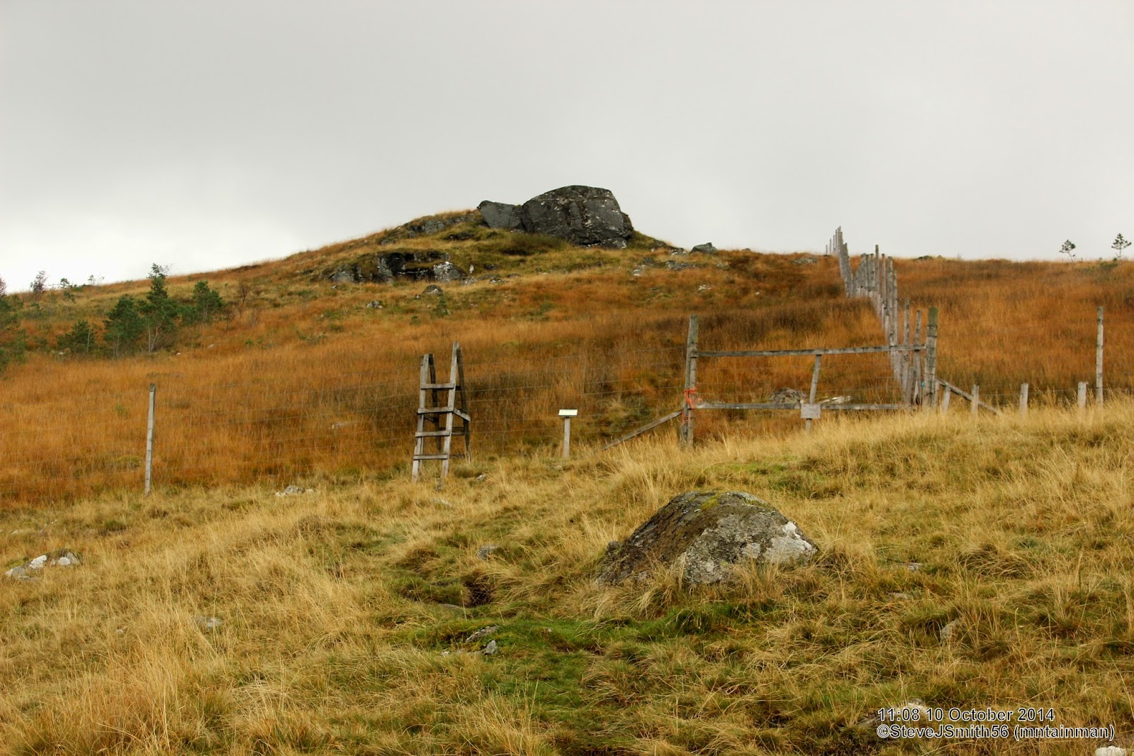 |
| Ladder stile over high fence to protect newly planted indigenous saplings from deer |
On a clear day it would give a good view of the route ahead but today with the return of the drizzle and low cloud I could only just about make out the scar of the muddy track heading north east towards Beinn Challuim South Top.
 |
| Beinn Challuim South Top. Not sure if cairn or rock is the high point |
Ben Challum [Beinn Challuim]
 |
| Approaching Beinn Challuim cairn from the south |
 |
| Looking back at Beinn Challuim South Top from Beinn Challuim |
Visibility was not brilliant but the path was easy enough to follow on the required bearing. A lone post did appear heralding the proximity of the fence to follow all the way back to the rail line. More or less before the next post was seen the cloud lifted (or I descended below the cloud) and the route home along the path at the side of the fence could clearly be seen.
 |
| Heading downhill (disused?) footbridge over West Highland Line near Kirkton Farm |
The one variation from the ascent was the path stayed with the fence and revealed the footbridge I had missed on the way up. It was fairly overgrown and I think little used but did provide some excellent frames for a few photos, especially as the sun decided to make its first appearance of the day.
Munro No29 signifying the passing of the 10% completion and now after Ben Lomond earlier in this trip my second solo Munro.
More Photographs
 | |
|
No comments:
Post a Comment